NYT Top Stories - Latest Updates
Trump Wanted Canada as the 51st State. He Ended Up Pushing It Toward the European Union.
E.U.-Canada Ambitions Face Reality Check as Trump Bristles
Trump’s Latest Threats Loom Over Fed’s Interest Rate Decision
Fed Raises Rates in First Major Step by Warsh to Contain Inflation
BBC World News - Latest Updates
US interest rates raised for first time in three years
Snapchat 'willing to implement' daily time limits for teens, boss tells BBC
Photos show widespread damage at US sites from Iranian attacks
EU chief backs plan for Canada to become 'associate member'
NPR National - Latest Updates
Here's why an Arizona medical examiner is working to track heat-related deaths

No one across the U.S. is consistently tracking climate-fueled deaths. One medical examiner has a new protocol on heat-deaths.
(Image credit: Cassidy Araiza for NPR)

House passes Russia sanctions, sending bill named for Lindsey Graham to Trump's desk

The legislation was named for the late South Carolina Republican. It gives the president authority to impose tariffs on top importers of oil and natural gas from Russia, such as China and India.
(Image credit: Mariam Zuhaib)

You'd expect homeowners to save their stuff. Federal policy pays them to leave it
NPR dug into the upside-down world of FEMA flood insurance in coastal areas, and found many homeowners have no financial choice but to let their homes collapse.

Committee investigating Epstein holds billionaire Leon Black in contempt of Congress

Billionaire investor Leon Black refused to appear before the committee investigating convicted sex offender Jeffrey Epstein for a deposition. Now it's up to the Department of Justice whether to pursue criminal charges.
(Image credit: J. Scott Applewhite)

Wired - Latest Updates
Meet Dyson's New Robot Vacuum Line: The Dyson Nurovi Line (2026)
Here’s What Snap’s Expensive Specs Can Actually Do
OpenAI Creates a New Framework to Disclose Bad AI Behavior
Washington Won’t Be Regulating AI Anytime Soon
NASA Breaking News - Latest Updates
Passion Meets Precision at NASA’s Flight Research Lab
4 min read
Preparations for Next Moonwalk Simulations Underway (and Underwater)

Long before they helped shape NASA’s future aerospace breakthroughs, Derek Abramson, Justin Hall, and Justin Link were in their garages and homes building radio‑controlled aircraft, testing new ideas, and flying their creations at hobby events. That early passion now fuels the work of NASA’s Dale Reed Subscale Flight Research Laboratory at the agency’s Armstrong Flight Research Center in Edwards, California.
At NASA Armstrong’s subscale flight lab, the team turns that lifelong enthusiasm into mission-focused innovation. The laboratory supports research that ranges from advanced navigation systems for future landings on the Moon and Mars to emerging aeronautics concepts that need quick, low-cost evaluation. NASA’s small, remotely piloted and autonomous aircraft allow engineers to explore ideas that could be difficult, risky or expensive to test at full scale.
Skilled team
Abramson, Hall, and Link play key roles in that work. Abramson serves as the laboratory’s chief engineer. Hall is the chief pilot. Link is a drone pilot. Together, they integrate emerging aerospace technologies with the lab’s subscale aircraft fleet and, when needed, design and build aircraft or flight experiments to evaluate new concepts.

Abramson’s expertise, built through service in the U.S. Navy and the aerospace industry, centers on technical oversight, management, and system design. Hall is known for creative approaches to problem solving and uses practical methods to address technical challenges and maintain flight safety. Link specializes in designing and fabricating research vehicles and draws on extensive hands-on experience to understand what works, and what does not, in flight.
On weekends, the team often tinkers in their garages or hangars building radio-control aircraft, researching hobby trends, or exploring new technologies. You might see them flying their creations at hobby events or attending trade shows. Their passion for flight brought Abramson, Hall, and Link together years before they one-by-one joined NASA more than a decade ago, though each discovered that spark in a different way.
Early influences
Abramson’s interest began as a child with rubber-band powered stick and tissue aircraft and radio-controlled models. His early aviation pursuits led to his first solo flight while in high school and a pilot’s license. In the Navy, he worked on multiple aircraft, including EA-6B and the F-18, as an avionics technician. As an engineer, he supported the B-1 and CV-22 Osprey aircraft flight tests. As an intern at NASA Armstrong, he used his operational and engineering experience on remotely piloted and autonomous aircraft.
Hall’s interest grew after seeing historic aircraft including the Mach 3 SR-71 fly over his elementary school playground and watching Space Shuttle Challenger land from above his dad’s shoulders. He has built and flown model and remotely piloted aircraft for as long as he can remember. His reputation flying radio-controlled hobby aircraft at fly-ins and trade events led to an offer to fly subscale aircraft at NASA.
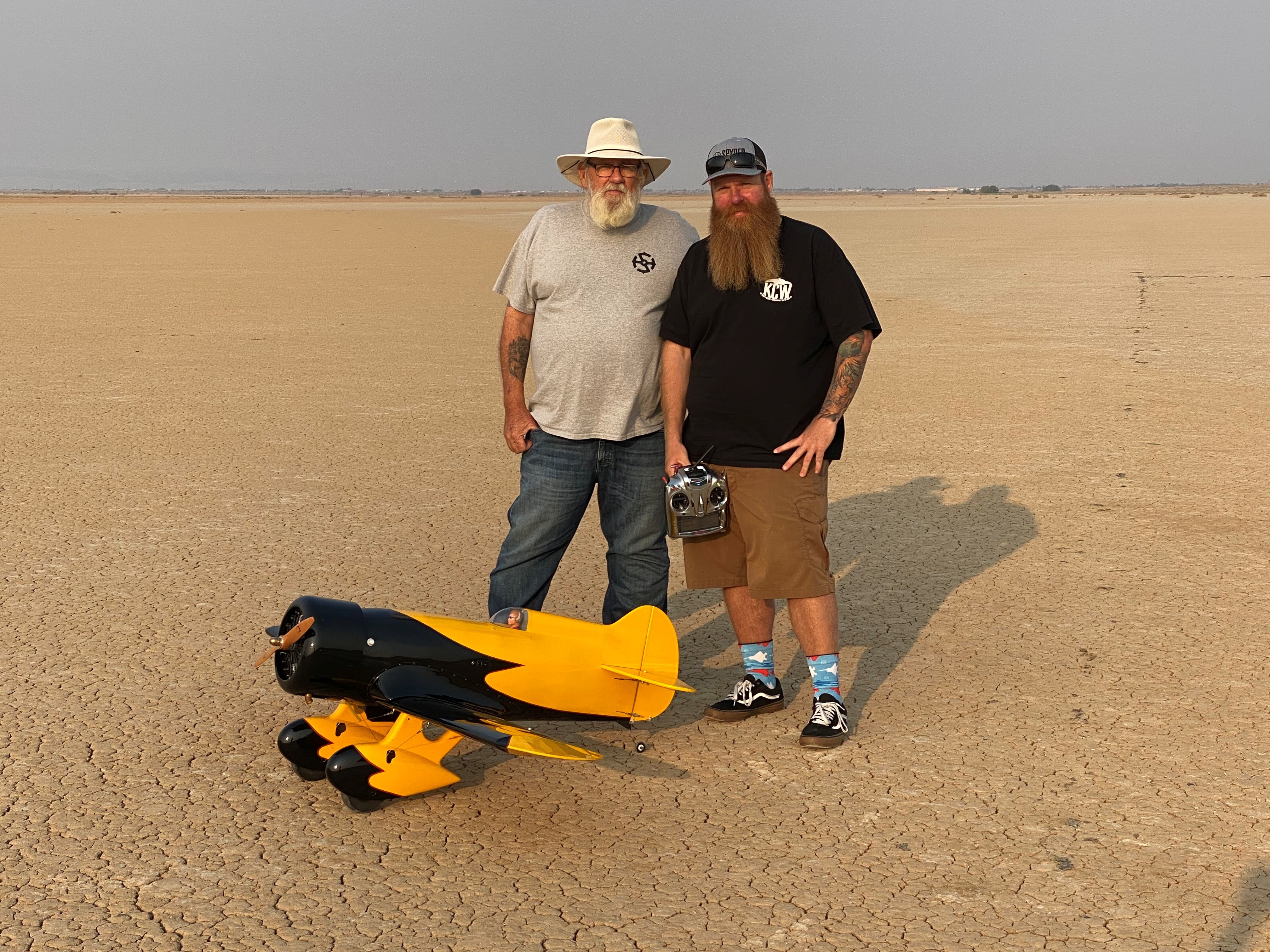
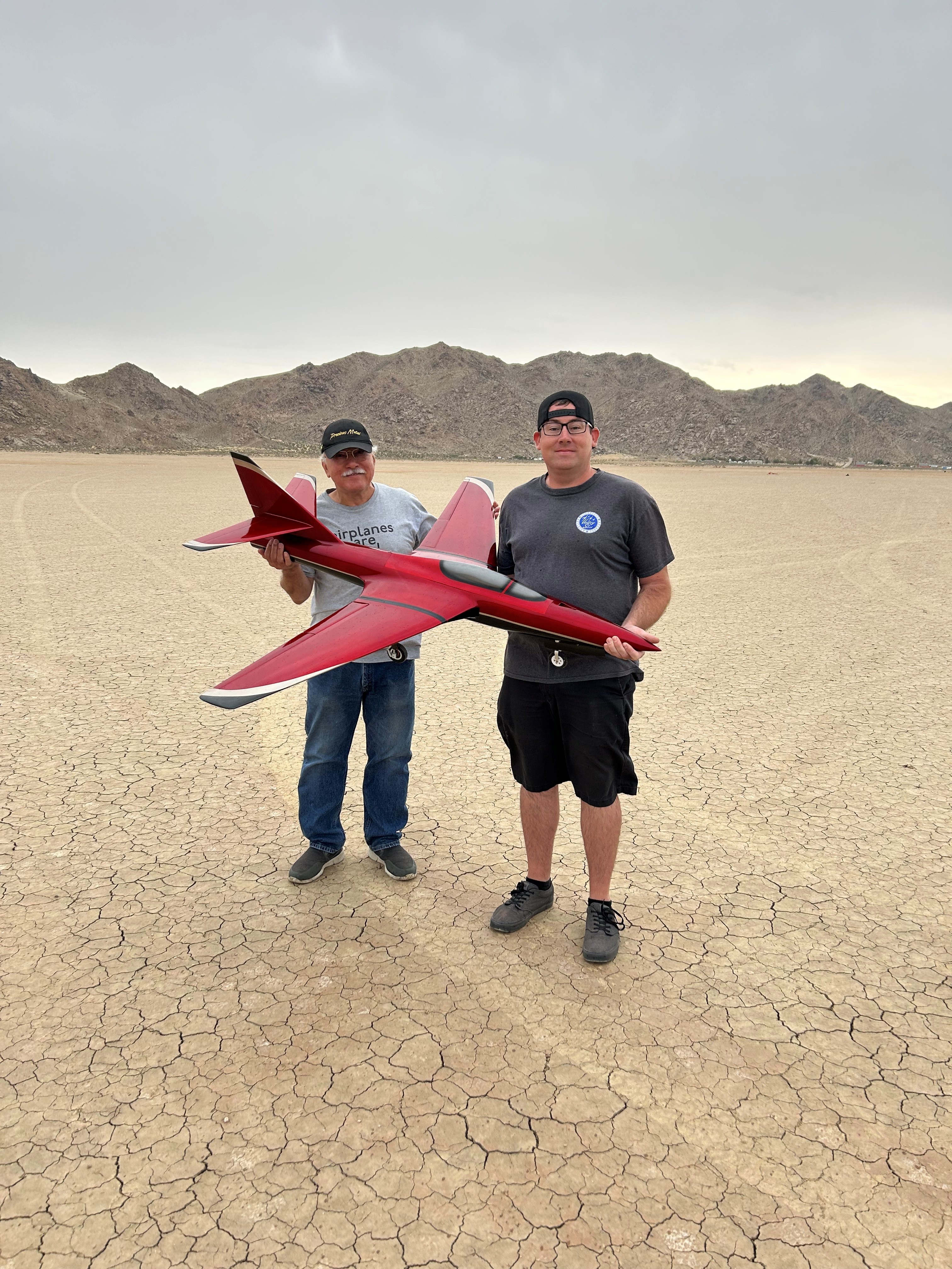
Link was five years old when he built balsa-wood aircraft with his dad and flew them in a field near their home. As he grew older, his hobby expanded to include radio-controlled cars, boats, helicopters, and aircraft. Aviation runs deep in Link’s family. His great grandfather served in the U.S. Army Air Corps, his grandfathers served in the U.S. Air Force, and his dad was an Air Force avionics technician. Link raced sailplanes, competed with scaled warbird aircraft, and was encouraged by family and friends to pursue an aviation profession. He has worked with large drones for more than 11 years, focusing on research and development, composite materials, and specialized fabrication methods.
Together, the team applies its experience and knowledge in rapid design, fabrication, integration and flight testing to bring new ideas to flight. Their work continues to support NASA’s missions across aeronautics, science, and exploration.
Share
Details
Related Terms
Explore More


NASA’s Moon Orbiter Spots New, ‘Once-in-Century’ Moon Crater
NASA’s Moon Orbiter Spots New, ‘Once-in-Century’ Moon Crater
NASA Goddard/Intuitive Machines/Robert Wagner
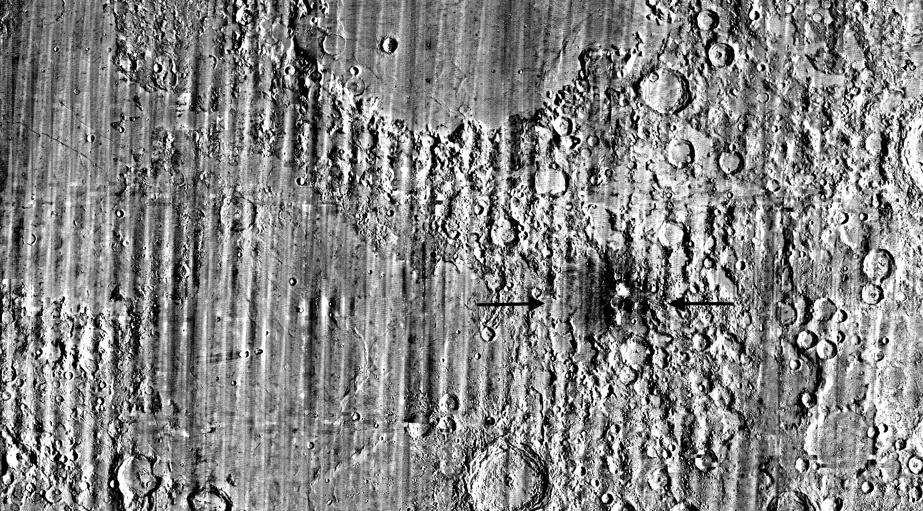
It started as a routine data-quality check. But as Robert Wagner, a scientist with NASA’s Lunar Reconnaissance Orbiter (LRO), scanned a giant Moon map on his computer screen, an unusually large bright spot circled by a dark halo caught his eye, as it implied that surface material in that area had been shaken up.
“I just stopped, dropped everything, and started looking into what that spot was,” said Wagner, an image-processing specialist from Intuitive Machines who works with data from the Lunar Reconnaissance Orbiter Camera (LROC) system.
By comparing before and after images of the Moon, Wagner realized he had discovered the largest, newly formed crater ever found in the solar system, as scientists reported Wednesday in Science Advances. This discovery highlights the value of NASA’s Moon orbiter data in studying a dynamic landscape as the agency advances a sustained human presence and expanded scientific and commercial activity on the Moon.
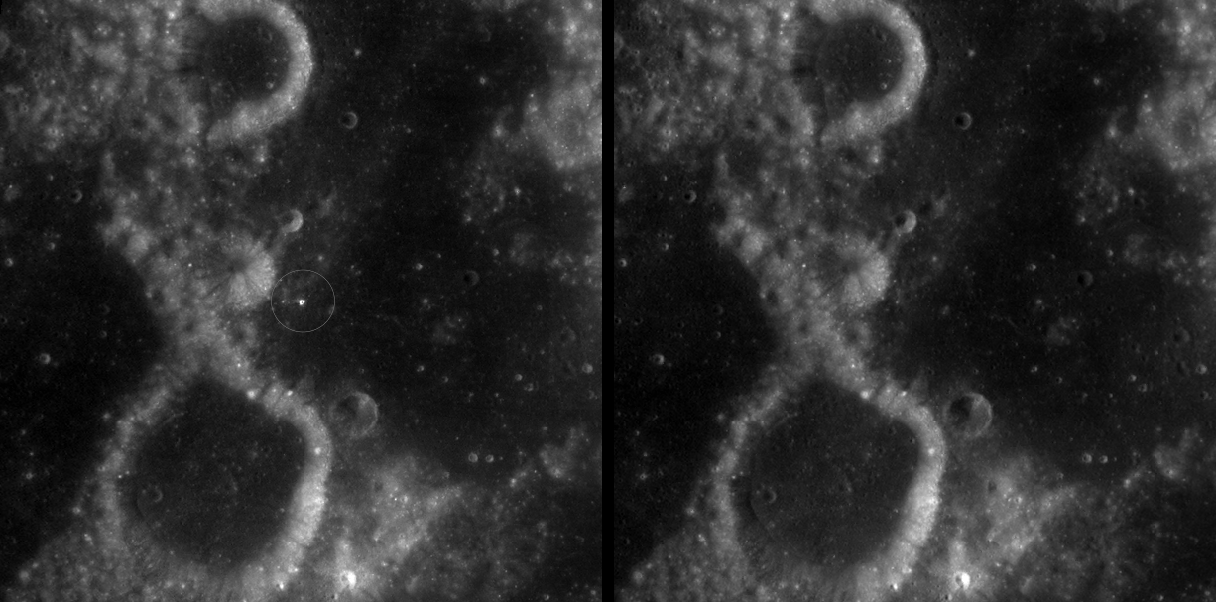
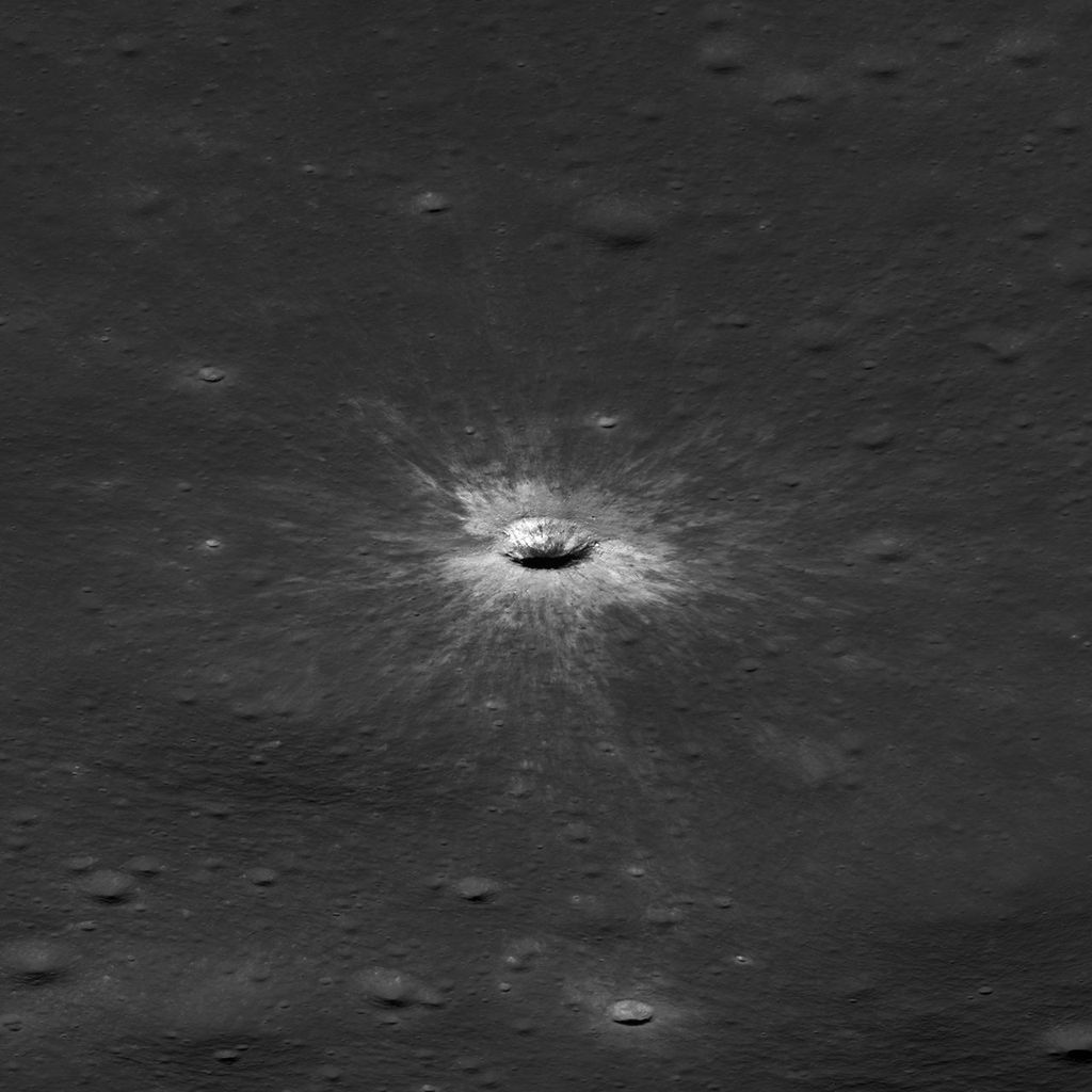
Officially named McGetchin after pioneering lunar scientist Tom McGetchin, the crater formed on the Moon’s eastern edge sometime between April 11 and May 22, 2024, after a comet or asteroid the size of a three- to six-story building hit the surface.
The crash left a crater, 728 feet wide, that spans the length of two football fields. And at 141 feet deep, the crater could fit three vertically stacked yellow school buses.
Scientists estimate that an impact of this magnitude happens on the Moon about once in a century or even longer.
Moon takes some hits
For more than 17 years, LRO has been circling the Moon and using its seven instruments to map the topography, surface composition, temperature, and radiation environment there. The spacecraft’s team has identified at least 1,000 new impact craters throughout the mission and flagged 100,000 more surface changes from an object smashing into the Moon or from the debris that flung out after.
With no atmosphere to slow them or burn them up, space rocks and other objects easily reach the lunar surface. Most are much smaller compared to the object that carved out McGetchin crater. The smallest craters scientists can distinguish from LRO images are about 30 feet wide, the length of a three-story building laid on its side, made by rocks about 43 inches wide, the size of a monster-truck tire. Scientists estimate that impacts of this scale produce about 140 new craters across the Moon each year. But most new ones are made by microscopic projectiles that leave holes too small to identify in orbital images.
With its numerous instruments, the spacecraft can observe changes to the lunar surface that aren’t apparent in the LROC images alone. After the crater was discovered, scientists working with LRO’s thermal instrument, Diviner, made follow-up observations of the site. They found a 4-mile-wide area around the crater that is about 16 degrees Fahrenheit cooler at night than its surroundings.
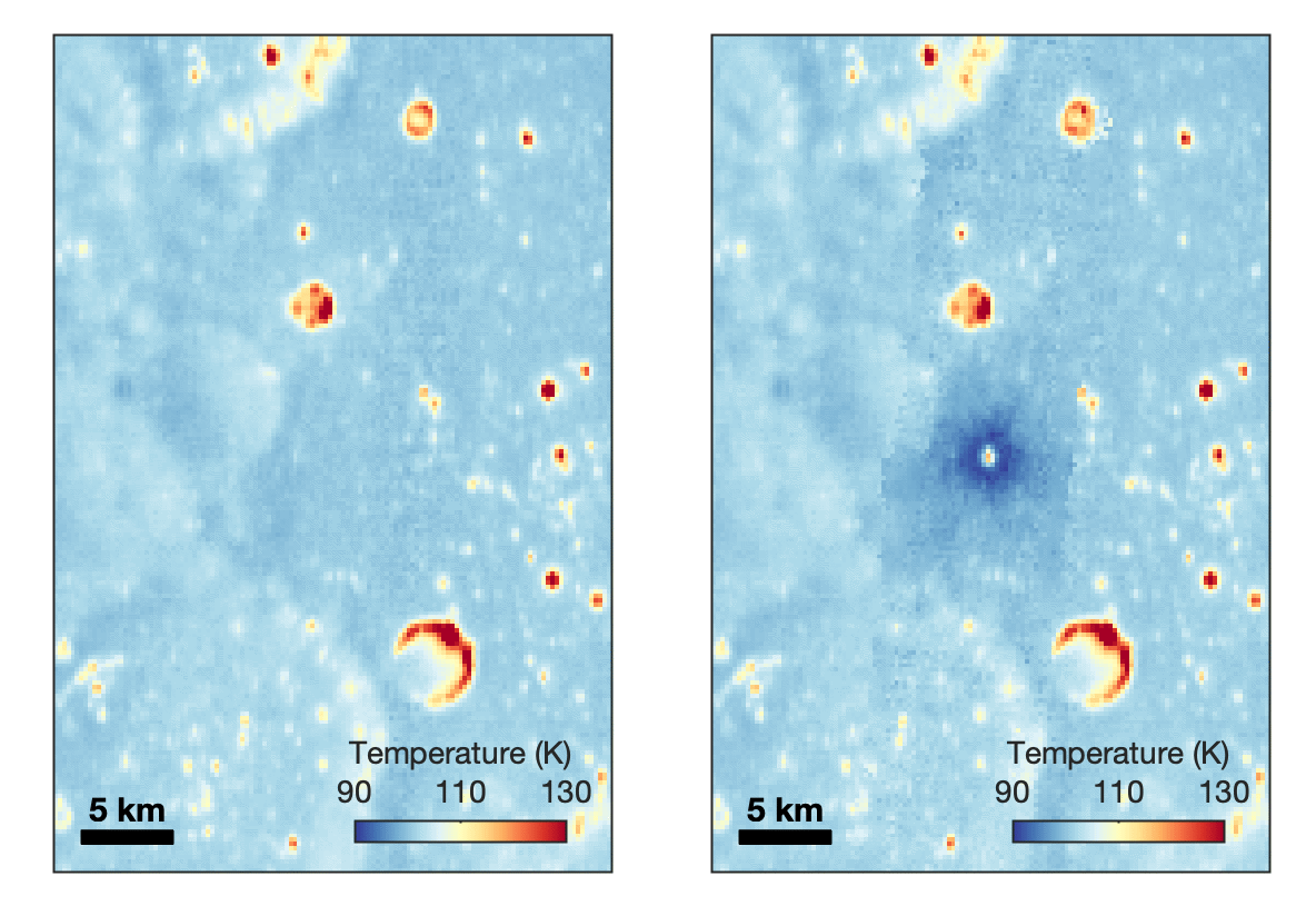
Reporting in a second paper Wednesday in the same journal, researchers say that the cooling happens because the impact fluffs up the regolith around the crater, making it less dense and therefore less able to retain heat.
The large extent of this “cold spot” is striking, scientists say, because it shows that impacts can modify the Moon’s surface far beyond the crater itself. These physical changes could affect how rover wheels interact with the surface, for instance.
Road to discovery
The LROC system collects images from about 60 miles above the Moon as LRO loops from pole to pole. The system includes two cameras that capture high‑resolution black‑and‑white images and one camera for moderate‑resolution multispectral images. Over the years and thousands of passes, scientists have built maps detailed enough to spot not only new craters, but also landslides, landers, seismic faults, and even hints of lava tubes.
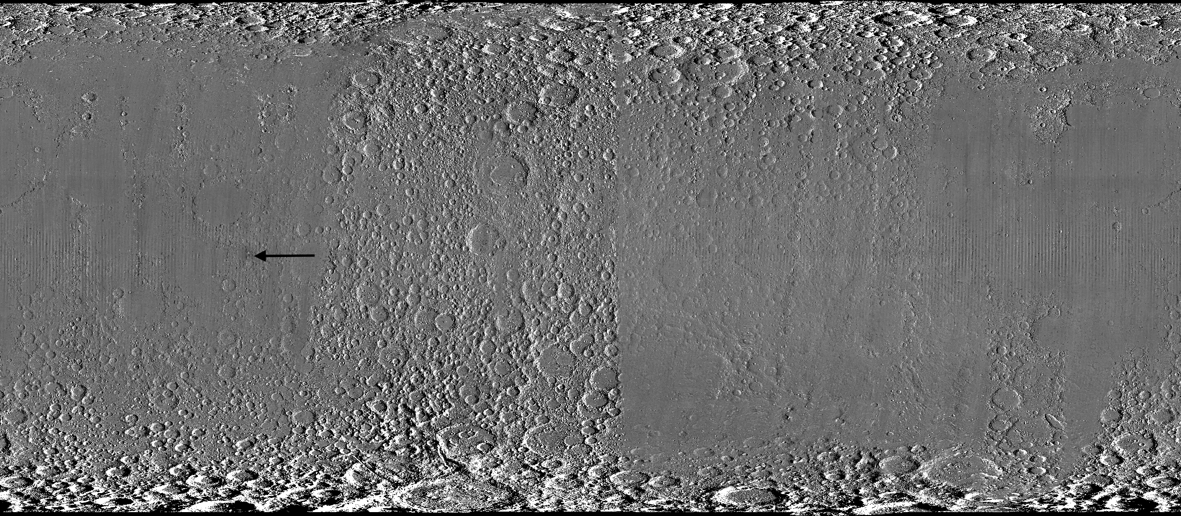
LROC scientists regularly analyze close-up images of small portions of the Moon’s surface taken by the Narrow-Angle Camera. Using these images, they look for changes that are typically less than 30 feet across. But every few years the team searches for large (wider than 150 feet) features by creating global Moon maps and comparing them to older versions.

That’s what Wagner was doing on Oct. 24, 2025, when he came across McGetchin. Using images from LROC’s Wide-Angle Camera, which captures broad views with pixels the size of football fields, he stacked hundreds of “before” and “after” frames with software designed to highlight change. Anything that stayed the same turned gray while anything different showed up as bright or dark patches.
While the process sounds straightforward, spotting real craters requires a lot of manual work. The software flags every tiny shift in lighting or shadow, generating hundreds of false alarms. For this reason, Wagner typically verifies the software, looking for small fuzzy halos around pixel‑wide bright points, which indicate splashes of regolith around a new crater.
Spanning hundreds of pixels, McGetchin stood out immediately. “It was by far the most obvious impact debris pattern I’ve ever seen in one of these images,” Wagner said.
After his discovery, scientists turned to the Narrow-Angle Camera, which takes much sharper views at about 3 feet per pixel. This camera’s close-up images, taken as LRO flew over the impact site again, revealed the crater size, shape, and how the surrounding terrain was affected. These images also helped researchers estimate the size and force of the rock fragment that formed the new crater, details that are expected to appear in a future paper.
Banner image caption: A zoomed-in view of the Moon, with debris around McGetchin crater visible as a white spot circled by a dark halo just right of center of the image (marked with black arrows). This is the view that Robert Wagner saw on Oct. 24, 2025, during a routine data-quality check. Wagner is an image processing specialist for NASA’s Lunar Reconnaissance Orbiter Camera, a system of three cameras. Using images from the Wide-Angle Camera (WAC), which captures broad views with pixels the size of American football fields, he stacked hundreds of images captured by WAC over the last several years with software designed to highlight change. Anything that stayed the same is gray; anything that changed showed up as bright or dark patches. The stripes in the image are due to slight changes in lighting between the older and newer images. This image composite shows an area of the Moon approximately 900 miles across.
About the Author

Lonnie Shekhtman
Shekhtman helps communicate NASA planetary science to the world through news and feature stories on NASA.gov, videos for NASA+ and YouTube, and by working with the media. She reports on lunar and Mars science and exploration; NASA’s search for life; missions to Venus, Titan, and Jupiter’s Trojan asteroids; and many other topics related to NASA’s exploration of our solar system and beyond.
Share
Details
Related Terms
Explore More


Simplified Summary
Scientists discovered a crater on the Moon that formed sometime between April 11 and May 22, 2024, after a comet or asteroid the size of a three- to six-story building hit the surface.
The crash left a crater, 728 feet wide, that spans the length of two football fields. And at 141 feet deep, the crater could fit three vertically stacked yellow school buses.
NASA Celebrates Restoration of Guam Station Damaged by Typhoon Mawar
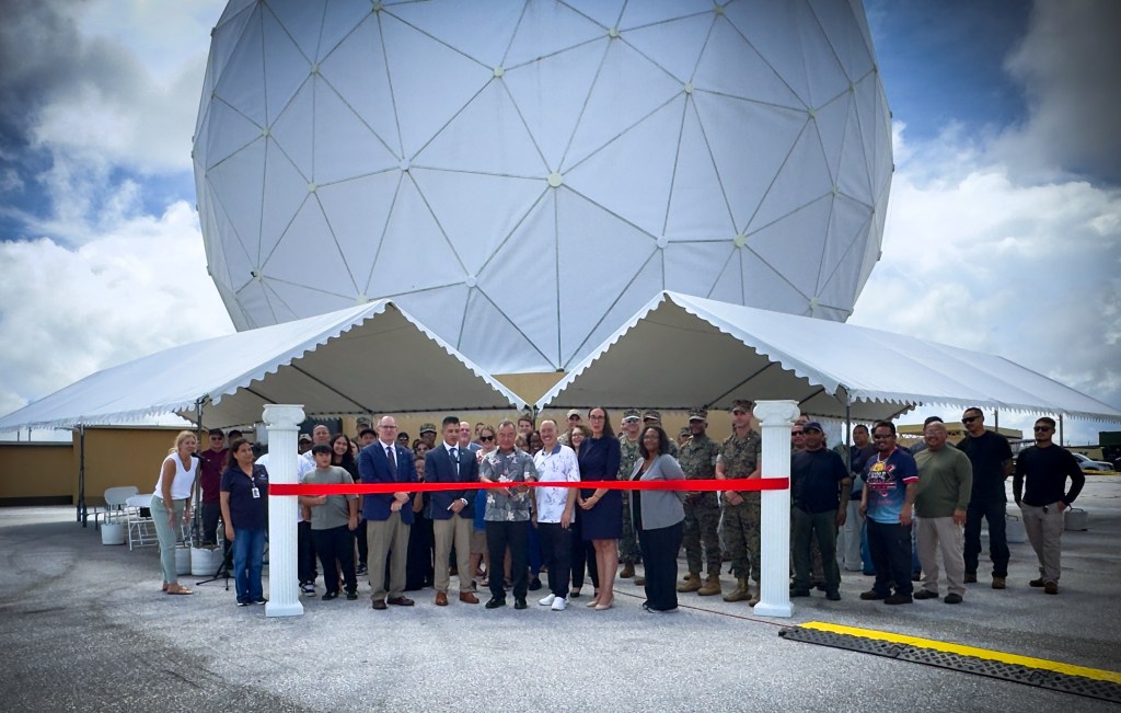
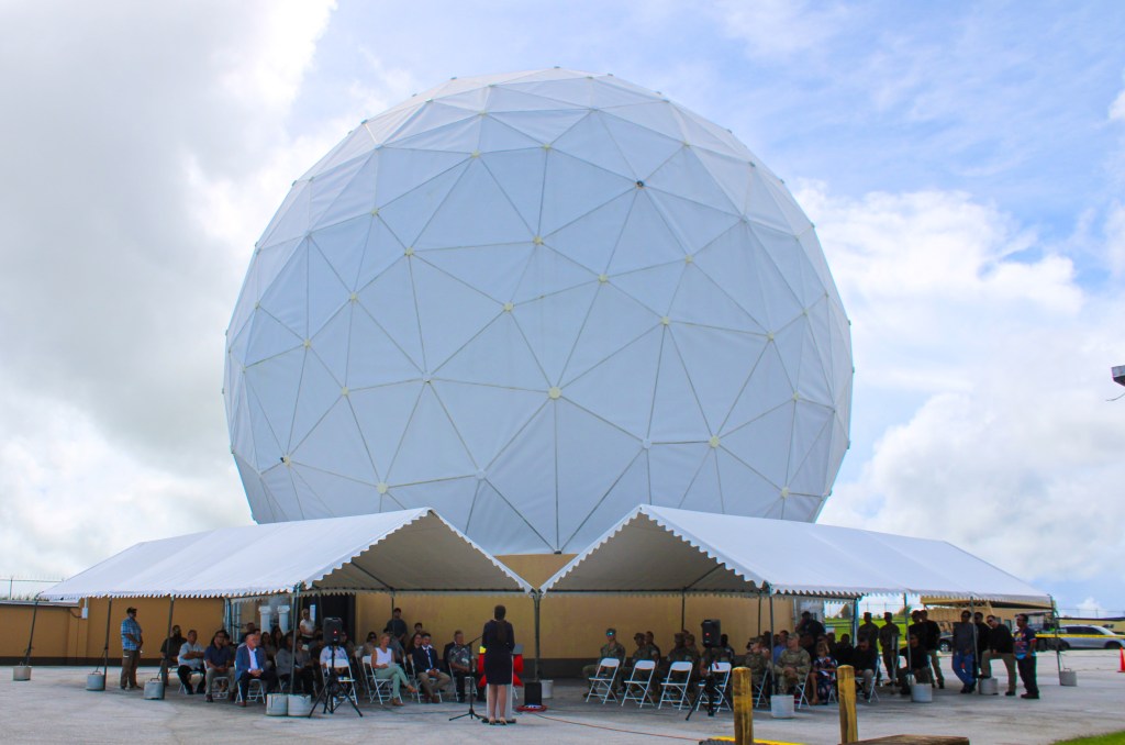
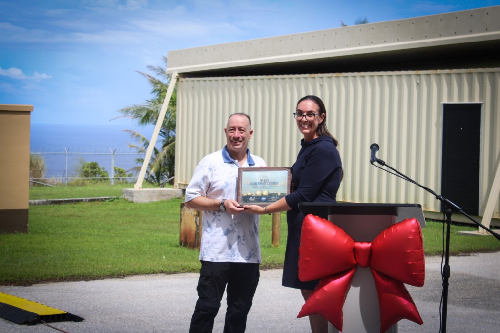
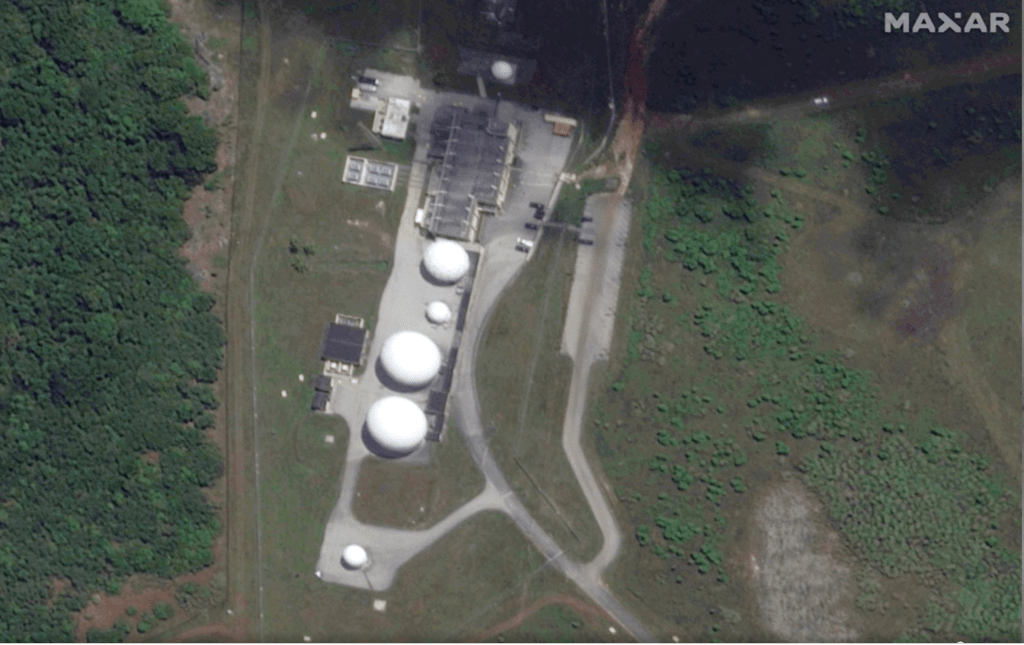
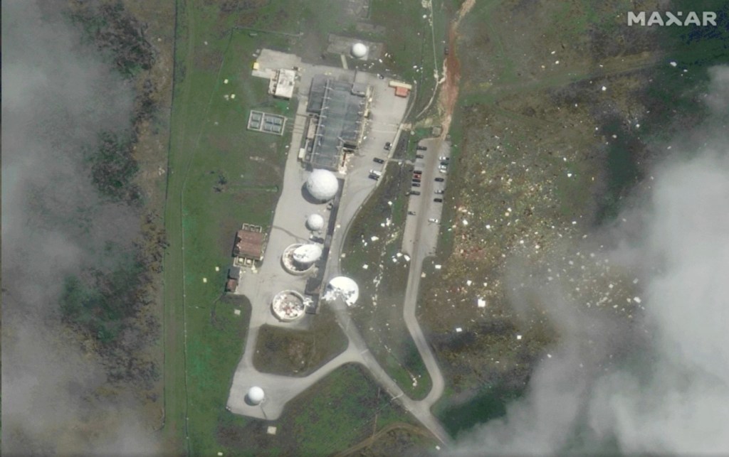
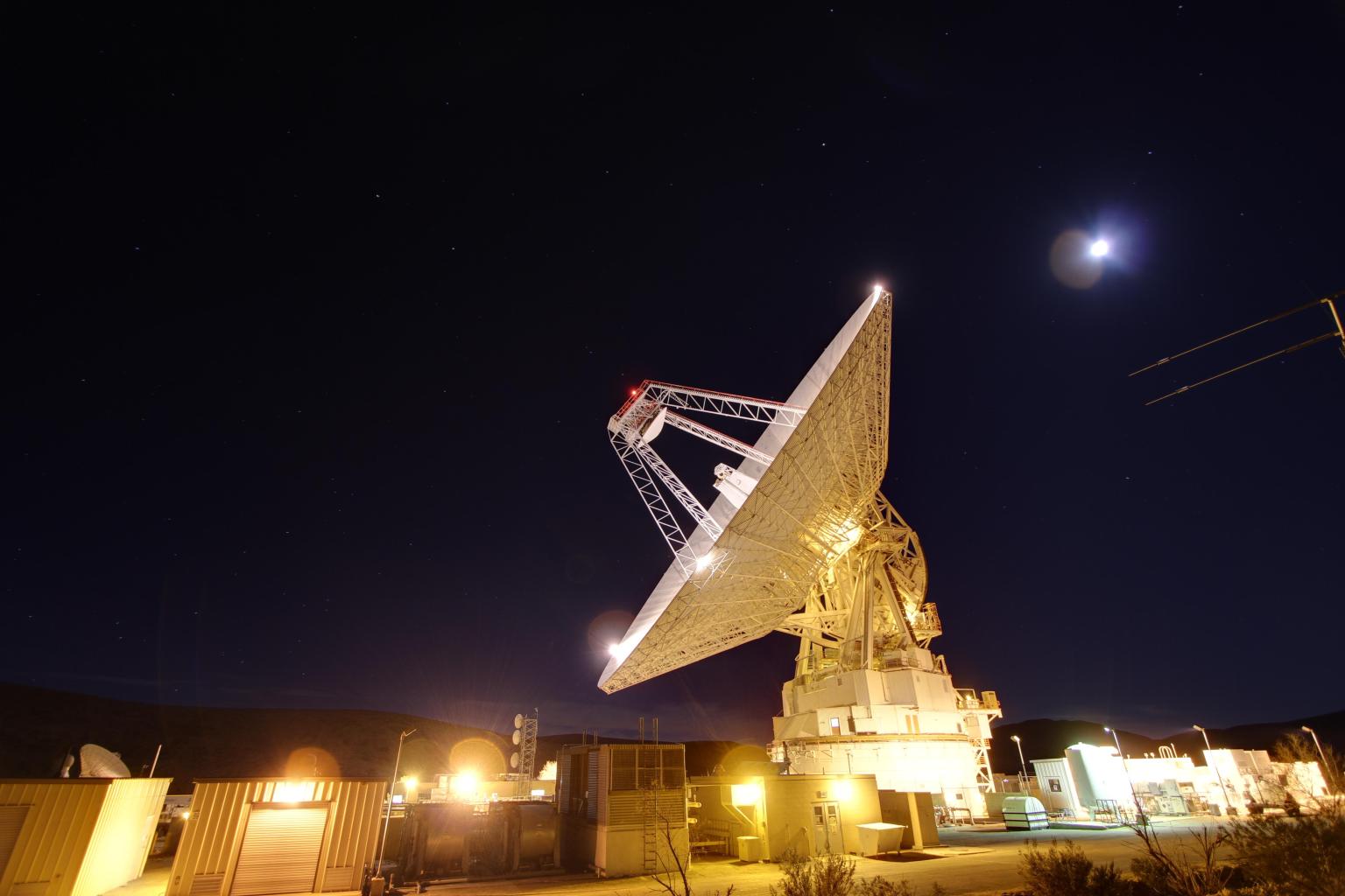
NASA celebrated the full restoration of its Guam Remote Station with a ribbon-cutting on Sept. 10, closing out more than three years of recovery after Super Typhoon Mawar devastated the site in 2023. Engineers from across the agency completed the final and most complex step of the rebuild on July 1, when they returned the station’s central antenna to service.
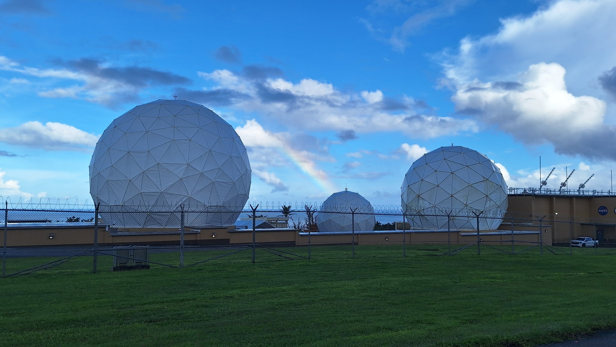
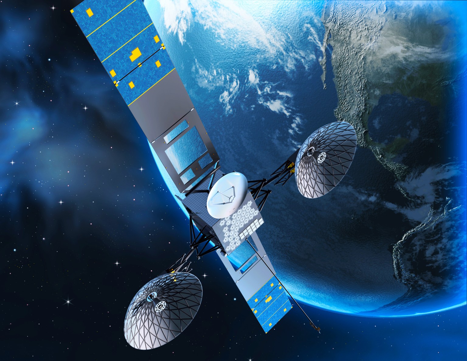
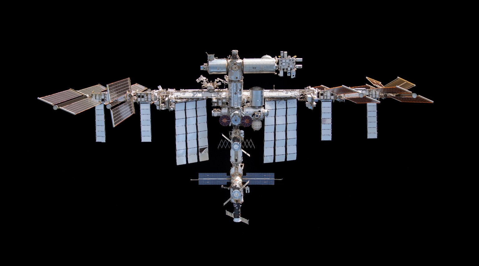
For nearly three decades, the Guam Remote Station has been one of three ground stations supporting NASA’s Tracking and Data Relay Satellites, or TDRS, a critical part of the Near Space Network. From 22,000 miles above Earth, the relays link spacecraft in low Earth orbit with the ground, allowing flight controllers to communicate with astronauts, command spacecraft, and receive mission data. The Guam station alone closes the “Zone of Exclusion,” a stretch of orbit beyond the relays’ line of sight. Without it, the International Space Station can lose contact with Earth for up to 20 minutes of every 90-minute orbit, an unacceptable risk for crewed missions.
On May 24, 2023, the Category 4 super typhoon struck Guam with 185 mph winds and more than 28 inches of rain, destroying two 16.5-meter antennas and damaging an 11-meter north antenna and the Inter Facility Link building at NASA’s station. The Zone of Exclusion reopened for the first time since 1998, cutting TDRS coverage to about 85% of a spacecraft’s orbit.
NASA made emergency repairs to the least-damaged antenna and borrowed two mobile terminals from the U.S. Army to expand coverage. The patchwork restored partial service within months, in time for a November 2023 spacewalk.
In early 2025, Congress dedicated disaster-relief funding to rebuild the ground station and harden the network against future storms. Construction began that summer and finished in summer 2026, when the rebuilt central antenna rejoined TDRS operations and the Zone of Exclusion closed once more. The same appropriation funded critical upgrades at three additional Near Space Network ground stations.
The return to service of the Guam Remote Station’s central antenna represents far more than the restoration of a critical piece of infrastructure — it is a testament to the dedication, resilience, and ingenuity of the people who made it possible.

Jena Garrahy
SCaN Deputy Program Manager for Network Operations
At the ribbon-cutting, representatives from NASA’s SCaN (Space Communications and Navigation) Division joined the station’s workforce and local leaders to mark the central antenna’s return to service. The Guam team, which led debris removal, site security, and on-island recovery, was recognized for its work to keep NASA connected to its missions through the outage and rebuild. A companion ceremony at NASA’s White Sands Complex in Las Cruces, New Mexico, honored the engineers and specialists across SCaN who supported the recovery off island.
“The return to service of the Guam Remote Station’s central antenna represents far more than the restoration of a critical piece of infrastructure — it is a testament to the dedication, resilience, and ingenuity of the people who made it possible,” said Jena Garrahy, Deputy Program Manager for Network Operations. “Through long days, challenging conditions, and unexpected obstacles, this team remained focused on the missions that depend on these critical assets every day.”
The Near Space Network is funded by SCaN, a division of NASA’s Research and Technology Mission Directorate, at the agency’s Headquarters in Washington. The network is operated out of NASA’s Goddard Space Flight Center in Greenbelt, Maryland. Repairs of the Guam Remote Station were managed out of NASA’s Glenn Research Center in Cleveland.
About the Author

Korine Powers
Korine Powers, Ph.D. is a writer for NASA's SCaN (Space Communications and Navigation) Program office and covers emerging technologies, commercialization efforts, exploration activities, and more.
Share
Details
Related Terms

NASA Watches Earth’s Weight, Finds Center of Mass
5 min read
Preparations for Next Moonwalk Simulations Underway (and Underwater)
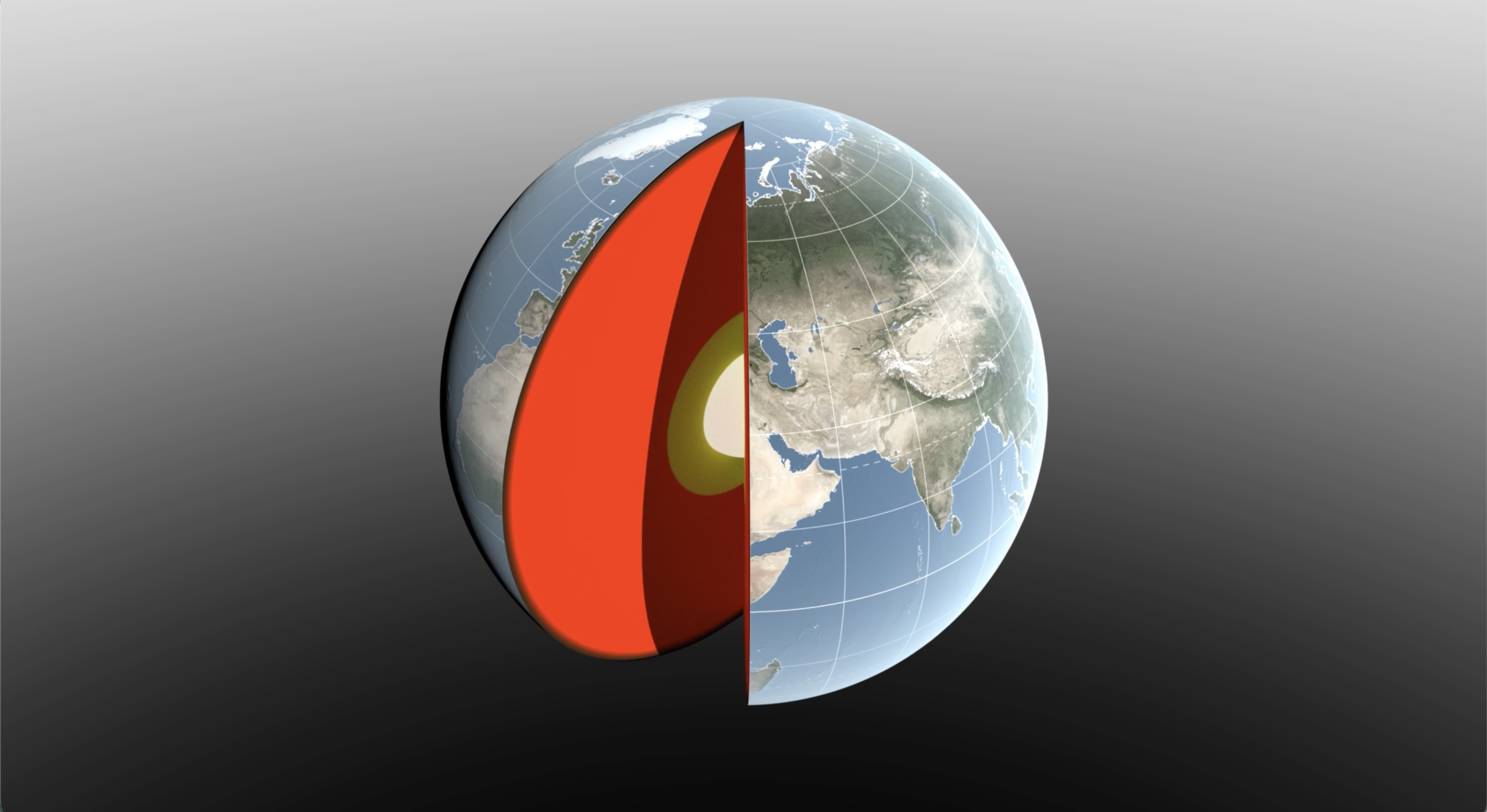
Seasonal changes redistribute enough water around Earth to shift the planet’s center of mass back and forth by fractions of an inch relative to its geometric center. NASA scientists are on the case, tracking the oscillations because Earth’s center of mass is a crucial reference point for satellite navigation and elevation measurements.
A team, led by NASA’s Jet Propulsion Laboratory in Southern California, has proposed a way to calculate the seasonal swings with extreme precision. The technique and findings are detailed in a new study published in Geophysical Journal International. The authors paint a vivid picture of springtime thaws, churning oceans, and dense winter air shifting massive surface loads from season to season.
The study isn’t the first attempt to pin down Earth’s center of mass. Scientists over the decades have pioneered several space-based techniques to define and locate it. But it’s a moving goalpost. If Earth were a hard blue marble, its center of mass would simply overlap its geometric center. In reality, the planet is sloshing and sagging under the weight of water, ice, and air. Because of this, Earth’s center of mass continually swivels around its geometric center by as much as several millimeters.
How accurate are existing methods to measure the size of the swivel? The last two international estimates, made in 2017 and 2023, differ by 0.27 inches (7 millimeters), about the height of three stacked nickels. The difference is almost as large as the motion itself.
To reduce uncertainty, JPL geoscientist Donald Argus led the development of a new technique based on ultraprecise satellite tracking.
Driven by gravity, satellites naturally orbit Earth’s center of mass, as if bound by invisible tethers. Tiny changes in the distance between satellites and ground stations reflect Earth’s shifting center of mass.
Using satellites to locate Earth’s center of mass is not a new idea. In fact, dense metal satellites, launched in 1976 and 1992, are dedicated exclusively to this purpose. Resembling 900-pound (408-kilogram) disco balls, both Laser Geodynamics Satellites (LAGEOS 1 and 2) are studded with reflective prisms and tracked with laser precision via ground stations globally distributed across more than 20 countries.
However, one limitation of satellite laser ranging is the uneven distribution of ground stations around Earth. The new technique improves accuracy in two ways: It adds GPS tracking into the mix along with orbital data from several satellites in low Earth orbit to provide a diverse array of targets. And it considers how the weight of water and ice deforms Earth’s crust, taking ground stations along for the ride.
The technique was developed by Argus along with researchers from JPL’s satellite orbit determination team, the University of Nevada, University of Montana, and the Helmholtz Centre for Geosciences in Germany.
“We’re now estimating the size of the movement of Earth’s mass center back and forth each year to be about half of what we believed it to be eight years ago,” said Argus. “Our findings suggest that the mass of Earth’s water and air moving between the hemisphere is smaller than previously thought.”
Felix Landerer, one of the study’s coauthors at JPL, noted that “while these movements might appear tiny, our modern world relies on extremely accurate positioning measurements. By unraveling and understanding the mechanisms that change reference systems, we can build better reference systems that ultimately benefit mapping and navigation — from global shipping logistics to precision agriculture.”
What they found
The study authors tracked Earth’s center of mass oscillating seasonally and attributed the cause to three categories: oceans, atmosphere, and continental water (made up of land ice, snow, lake and river water, soil moisture, and groundwater).
They found that snow accumulation in North America and Eurasia reaches a maximum in March and shifts Earth’s center of mass about 3 millimeters toward the North Pole. A month later, in April, rainwater in the Amazon River basin peaks at 2,400 gigatons, swinging Earth’s center of mass 2.2 millimeters toward South America. Monsoon water in southeast Asia attains a maximum of 600 gigatons six months later in November, adding slightly to the annual oscillation.
Between August and October, the oceans swell with meltwater and rain, and Earth’s center of mass shifts toward the South Pacific Ocean. The Pacific Ocean is so large that mass changes there overshadow the loss or gain in other oceans, though seasonal dynamics in the Mediterranean, Red, North, Baltic, and Barents seas all help shift Earth’s center of mass in their own small way.
The researchers used a model developed by the European Centre for Medium-Range Weather Forecasts to estimate how atmospheric changes affect Earth’s center of mass throughout the seasons. They found that cold, dense, winter air helps tip the scales over Arabia, Asia, and northern Africa around Dec. 21 each year, and over South America and South Africa around June 21.
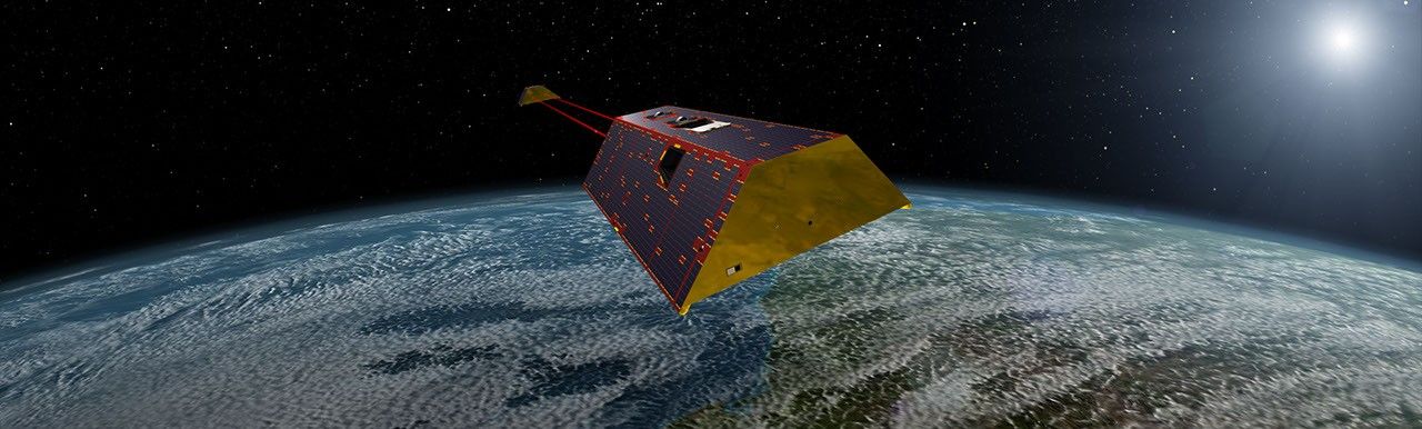
The mass calculations in the study are consistent with observations made by the Gravity Recovery and Climate Experiment Follow-On (GRACE-FO) mission. Launched in 2018, the mission is made up of twin satellites that map monthly fluctuations in Earth’s gravitational pull due primarily to the mass movement of water above and below ground. The two satellites fly in precise formation, and when the lead satellite passes over a dense body, like a swollen river basin, the extra gravitational tug changes the distance between its twin by a small but measurable amount.
The GRACE-FO mission is a joint partnership between NASA and the German Research Centre for Geosciences (GFZ). The next-generation GRACE-Continuity (GRACE-C) mission is targeting a launch in late 2028 to extend the nearly 25-year GRACE-series data record.
-end-
Written by Sally Younger
2026-061